The City of Ottawa’s “Digital Twin” project aims to deliver “transformational” improvements to municipal planning.
The geospatial visualization tool drew praise from councillors after a recent update from the team developing the technology.
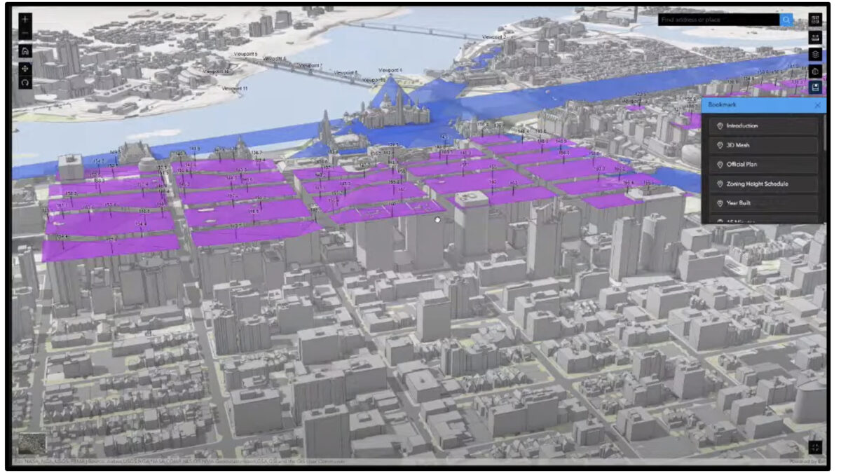
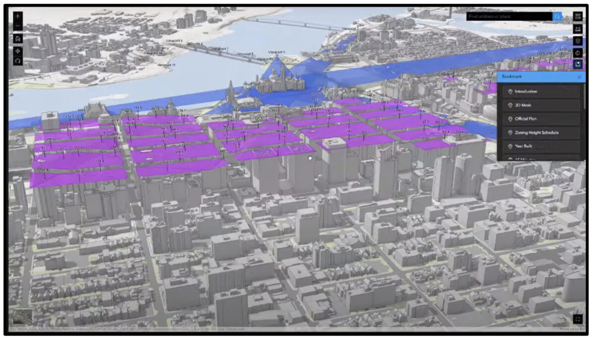
The project combines high-resolution imagery, data analytics, 3D laser scanning and virtual reality that its developers say will change the way planners envision the constantly developing capital for years to come.
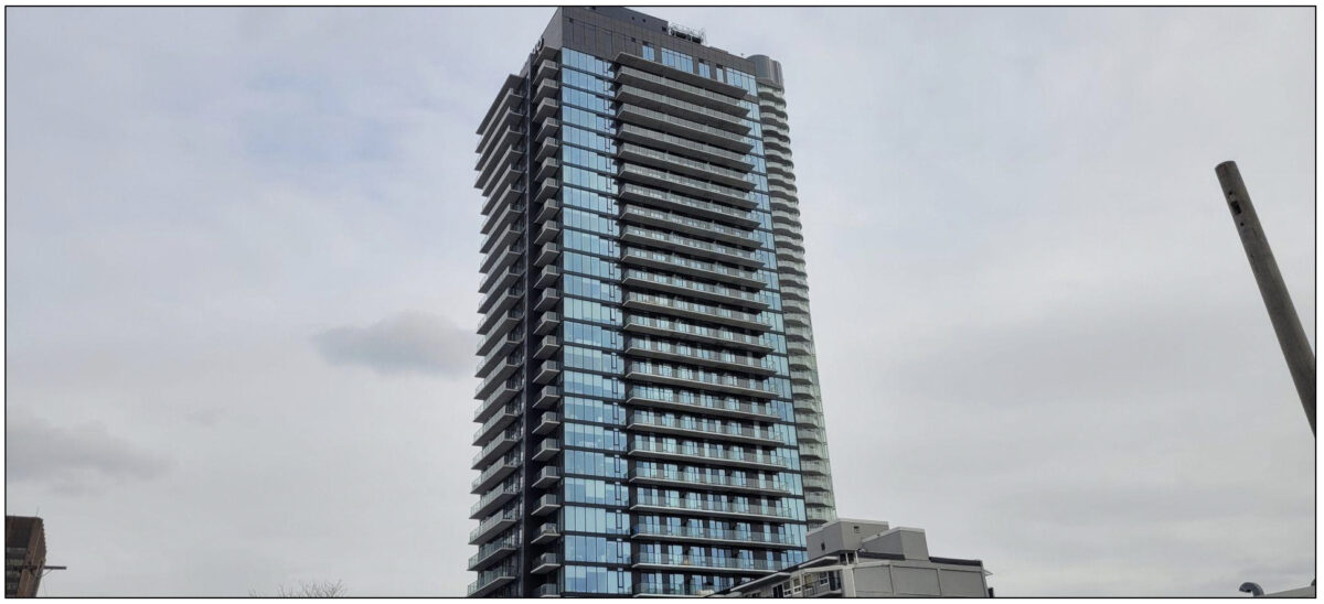
The technology will, for example, allow neighbourhoods to better imagine how a new high-rise will shade surrounding houses and parkland.
The project, sometimes called the “Otwin”, is the brainchild of the city’s Geospatial Analytics, Technology and Solutions unit. The initiative has been in development for about two years, but the city has used similar 3D modelling technology since the early 2000s.
Digital Twin, though, is a big step up from earlier tools, as it adds many layers of technological advancement to traditional 3D imaging.
“If you’ve done a home renovation project, the first thing you’re going to ask is ‘what does it look like?’,” said Randal Rodger, head of the Digital Twin program. “The power of the Digital Twin is that you can visualize. It can show you the built environment of yesterday, today and the proposed future.”
The Digital Twin is an electronic model of the city that supports efforts to consolidate zoning bylaws and the Official Plan, which is the vision for how the city will develop.
If you’ve done a home renovation project, the first thing you’re going to ask is, ‘What does it look like?’ The power of the Digital Twin is that you can visualize. It can show you the built environment of yesterday, today and the proposed future.
Randal Rodger, head of the Digital Twin project, City of Ottawa
The high-resolution model will allow developers to see visualizations of planned developments in the context of various bylaw restrictions.
The 3D visualization is photorealistic and is compatible with virtual reality headsets.
“With the headset, we can put you inside the model and you can have a 360-degree view to see what a development would look like from your house three blocks away,” Rodger said.
The Digital Twin project took some inspiration from 3D geospatial modelling used in Boston. But GATS Ottawa has become an innovator in digital twin technology. This led to the project coordinators earning an international award — the Esri Special Achievement in Geographic Information System technology — in 2023.
The award, presented annually by the California-based Environmental Systems Research Institute, recognizes “exceptional use of GIS technology to visualize and plan urban development in new ways”.
Building a Digital Twin is enhanced through partnerships, and the GATS project leaders said they want to collaborate as much as possible with Ottawa’s public health sector and other local institutions to utilize the technology.
For example, information about historical weather trends can be used to help map out which parts of the city are hottest and thus where shelter should be offered during extreme heatwaves.

“We now have an automated process where you can download imagery to create a heatmap in a short amount of time,” Rodger said. “That information is available to (Ottawa Public Health) and anybody who wants to help.”
The Digital Twin will eventually have published elements for the general public’s perusal. The targeted release for this is 2025.
At the city’s Jan. 31 planning and development committee, Rodger and geospatial strategist Jean-François Dionne gave an update on the progress of the Digital Twin project and provided a demonstration of the technology.
“We are actually creating data in 3D now,” Dionne said to the committees.
The presentation showcased the Digital Twin’s capabilities, but still only scratched the surface. Dionne highlighted several uses of the project, such as the ability to remove Bank Street’s winding powerlines from the field of view.
“This is a very powerful way of sharing visuals to clients, partners and in the future our constituents,” Dionne said. “They’ll be able to inspect, calculate distances, clearances, offsets in our right of way and do the work from our desktop, which is great for carbon emission control.”
As a member of the planning and housing committee, I will be better able to get a sense of how a proposed application will fit into the neighbourhood. Currently we work with drawings and renderings that are flat, so having a 3D understanding of the buildings would make a tremendous difference.
Laine Johnson, city councillor, College ward
Councillors said they were impressed with the project after years of discussion and development leading to the full-fledged demonstration.
“As a member of the planning and housing committee, I will be better able to get a sense of how a proposed application will fit into the neighbourhood,” said College Coun. Laine Johnson. “Currently we work with drawings and renderings that are flat, so having a 3D understanding of the buildings would make a tremendous difference.”
In the next few years, commercial and residential development in Ottawa will begin to reflect the impact of the Digital Twin and its various functions, said Rodger. The next step is for the tool to be made more widely available to city staff members, before the general public gains access to some of its features.
While it may at first seem just like an enhanced 3D model of the urban landscape, its developers said the Digital Twin will provide city planners, developers and communities everything they need to help Ottawa grow and evolve in the most efficient and sustainable way.
“It’s the power of where,” Rodger said. “Almost anything a municipality does, the first question is, ‘Where is that?’”