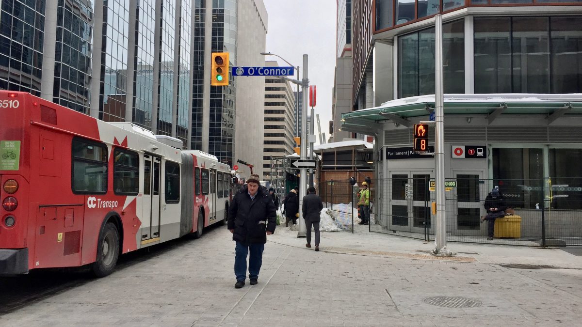
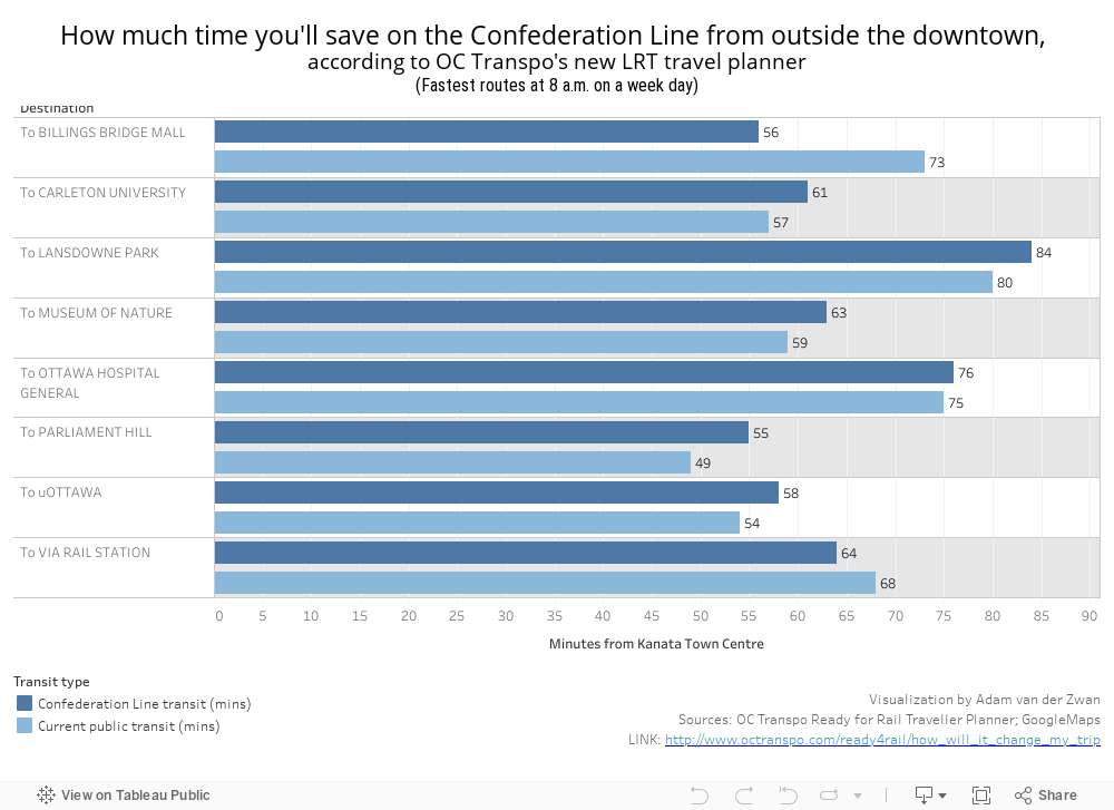
Public transit user Sam Boswell says when the O-Train Confederation Line finally opens, OC Transpo’s new web travel planner won’t help her choose a faster route. That’s because it now shows her routes to downtown Ottawa from Vanier will take even longer.
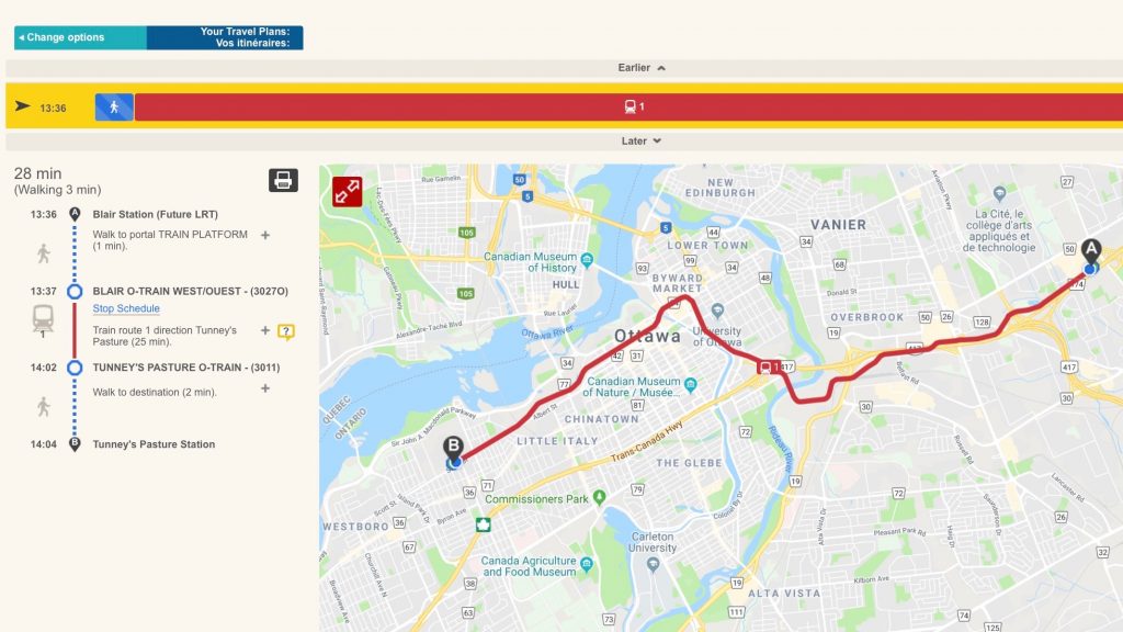
“My travel time goes from 33 minutes to 45 minutes,” said Boswell, referencing the estimated time the app shows for her new route. The Ready for Rail planner shows minute-by-minute breakdowns of the routes planned to run alongside the new LRT

By releasing the app months ahead of the LRT’s launch, OC Transpo wanted to show transit users their future commutes, transfer locations and estimated walk-times and help them prepare. While the app is in a test phase, some transit users have expressed concern about routes — some of which are their current routes — that are projected to be longer rather than shorter, as a result of LRT opening.
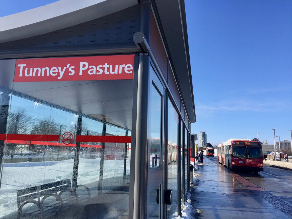
Rithvik Achyuthan, a Carleton University student from Stittsville, said his daily commute to school on public transit already takes over an hour. With the Confederation Line opening, the new travel app shows that his regular bus will stop at Tunney’s Pasture Station where he would transfer to the train.
“It’s not great because I’m adding more time to an already long commute,” he said. “If I miss the train, I will have to wait more time.”
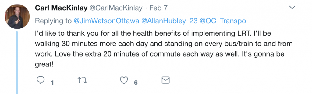
Comments on Twitter echo these reactions. While some people said they were satisfied, others found that estimated transfer times were too long.

Pat Scrimgeour, the city’s director of transit customer system and planning, explained in an email that the planner combines algorithms from Google Maps and OC Transpo’s scheduling system to provide travel plans that consider the fastest walking routes and fewest transfers.
OC Transpo says on its website that because the Confederation Line trains will run every five minutes or less during peak traffic period, congestion will no longer delay service throughout the city.
“Trips will be more consistent and dependable,” Scrimgeour said, but didn’t explain why some of the app’s routes may take longer than what they are now.
Boswell, a co-founder of Ottawa Transit Riders, a newly formed grassroots group that advocates for easier public transit, says the city should have consulted with the public to ensure the planner was user-friendly and the projected routes were more convenient.
Boswell adds OC Transpo’s justification is that the train is going to be more reliable, so it doesn’t matter if the overall route takes a little longer.
She says that the travel planner might also lead visitors and newcomers astray with indirect routes, positioned around the LRT line.
“I’m lucky because I’ve lived in Ottawa my whole life,” Boswell says, adding that if the app gives her bizarre directions, she would recognize that. At this point, she thinks Google Maps is more accurate than the new travel planner.
OC Transpo says that the app is being tested and is meant to offer “a picture” of future routes. It is encouraging transit users to comment about the app on the OC Transpo website.
If I want to take my regular routes from the Merivale-Viewmount area to areas I normally travel – ie Glebe, General Hospiital, Carlingwood, South Keys, Hampton Park, will the routes which now get me there be still working on the same frequency? I understand that to go downtown to Byward and Rideau Centre area I would have to take a bus to Tunney’s Pasture to get downtown but will the routes be reduced ?
It has been reported that many buses will be mothballed and drivers let go but service to the outlying areas at hours when shift workers need to travel across-community is so poor that people must take their cars. Getting from Kanata south to Kanata north takes so long that driving is the only viable way for workers to get to and from work. For students to get to part time jobs and low-income workers in the light-industrial areas, bus service is severely restricted, meaning that many families must have at least two cars because they cannot take buses.
Finally, raising fares will only serve to push people away from transit if they have a choice, while placing undo hardship on those who are dependent on public transit. There must be a better way to reduce costs incrementally until Ottawa has the lowest fares in the country. Perhaps some kind of bond could be created to allow the purchase of smaller side-entry buses (electric?) which could accommodate the mid-day travellers using walkers, strollers, grocery carts and wheel chairs on routes which have traditionally low occupancy. With climate change urgency we MUST get more cars off the roads.